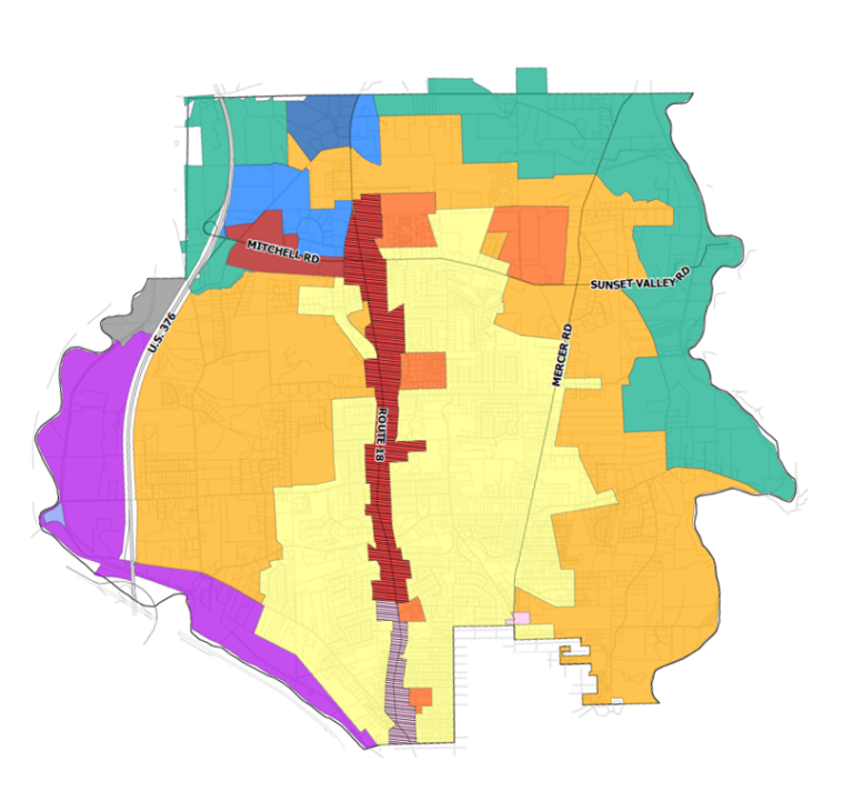
A future Starbucks on Route 18 will not only be the first Starbucks in Neshannock Township, but also the first building to be developed in the township’s new Route 18 Overlay District. As a priority in the township’s comprehensive plan, the overlay district was created to inject contemporary urban design practices into Neshannock’s main commercial corridor. As a tool planners use to change the way part of a community functions, overlay districts aren’t always the right choice, but the Route 18 Overlay is right for Neshannock.
Route 18 functions adequately for this small municipality, but as a business corridor, it’s aging and lacks cohesion. On the site of a former bank building, set back from the road and surrounded by a parking lot, the newly constructed Starbucks will reflect the design quality Neshannock wants to see in future years.
Neshannock’s 2017 Comprehensive Plan and its 5-year Update, Neshannock 2030, were written by Strategic Solutions®. Since 2017, the township has updated its zoning code and development standards including the addition of the overlay district along Route 18. The firm’s senior planner, Alyssa Kelly, has been tasked with reviewing Starbuck’s development plan for compliance with the new overlay zoning regulations.
“Using good urban design principles to encourage development that’s in line with Neshannock’s vision for the corridor is what the overlay is all about,” Kelly says. “That includes factors like façade materials and building height, window size and placement, and landscaping and parking requirements.”
Route 18 has long been auto oriented and will remain so, but Kelly says the overlay will improve connectivity for both cars and pedestrians over time.
As the name suggests, overlay districts are placed on top of—and thus supersede—already established zoning districts. With defined boundaries (usually smaller than underlying zoning districts), they are typically used to address specific conditions, such as preserving historic structures, protecting environmentally sensitive areas, or furthering a municipality’s development goals related to such things as density, housing affordability, or transportation.
Overlays are permitted by the PA Municipalities Planning Code (MPC) and are used across the U.S, including in Ohio where Kelly previously worked as a planner for the City of Upper Arlington. Changing the base zoning is preferable to overlays in many circumstances, Kelly says, but overlays can be effective when they have a clear purpose.
“Overlays are by definition in conflict with underlying zoning regulation, but they can also conflict with each other, so it’s important to use them selectively,” she says.
The Route 18 Overlay is not overly prescriptive or intended to change the corridor overnight, Kelly adds, but is “more of a framework that will enable the township to change the corridor incrementally over time, in ways that will encourage new businesses and improve the marketability of properties in the area.”
To spur economic development, a key recommendation in Neshannock 2030 is the creation of a master plan for the Route 18 corridor that will build on the overlay by addressing vacant properties, identifying priority development sites, and helping to secure a Main Street designation.
Alyssa Kelly has a bachelor’s degree in city and regional planning and a dual master’s degree in city and regional planning and environmental and natural resources, all from Ohio State University. She leads several comprehensive and strategic planning projects for Strategic Solutions’ clients.
Strategic Solutions® has vast expertise with all aspects of zoning and land use. In addition to helping numerous communities draft and adopt effective ordinances and regulations, such as Subdivision and Land Development Ordinances (SALDOs) and other form-based zoning solutions, we have served as interim zoning officers and provided expert testimony in a variety of zoning cases.